El Orden de las Soledades

Con su espaciosa jerarquía
El orden de las soledades
Vienen los Pajaros
Paolo Neruda
With their spacious hierarchy
The order of the wild and lonely places
The Birds Arrive
Paolo Neruda
El orden de las soledades
Vienen los Pajaros
Paolo Neruda
With their spacious hierarchy
The order of the wild and lonely places
The Birds Arrive
Paolo Neruda
On Sunday we took our first hike of the trip. Venturing to a more remote location than we are likely to get to for the remainder of our time here, we drove to the Orocopia Mountain Wilderness at the far east end of the Coachella Valley. To get to the trailhead, you have to drive about 12 miles south of Interstate 10 on an extremely bad dirt road. So just to begin the hike takes you way out into the middle of nowhere.
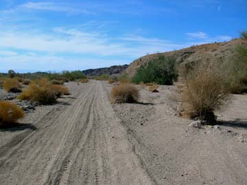
The trailhead
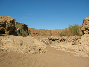
The hike itself begins by walking south along a jeep road (too sandy for us to drive on) that leads down the west side of a shallow valley. A series of low parallel ridges intersects the valley from the west. A series of canyons snakes back into these hills. The largest of these is called Red Canyon, for the dominant color of the rock formations. We chose the first canyon south of Red Canyon. It has no official name, and is referred to in our guide book as Parallel Red Canyon.

Near the entrance to Parallel Red Canyon
When you first enter the canyon, the sides are really just some low hills and the canyon in pretty shallow. About a mile up canyon, you encounter a dry waterfall. The right hand side of the waterfall in the picture looks like it’s made of cement. Actually, it’s the natural rock of the area, which includes lots of conglomerates- mixtures of various smaller stones fused together in a hard matrix. A close up view reveals pebbles that appear to have been mortared together. Leon believes that the mortar in this case is made of calcite crystals. The complex geology of an area like Parallel Red Canyon is described in John McPhee’s wonderful book Assembling California.
The dry waterfall
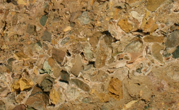
Conglomerate rock with calcite crystal "mortar"
Further up canyon, a small grove of palm trees appears. This is one case where knowing too much ecology can be detrimental to one’s enjoyment. The palms here are not the native California fan palms, but non-native date palms. They aren’t really a terrible ecological problem, but the salt cedar trees growing with them are scourges of the arid west. They can lower the water table and severely damage local ecosystems that depend on this water.

Date palm trees and non-native salt cedar. Thieves of water in a ravenously thirsty land
Beyond the palm trees, the cliffs really start rising up above the canyon floor. The geology becomes even more complex, as evidenced by the multicolored strata of the canyon walls. The darkest strata are pillow basalt, which forms under the ocean. This is pretty ancient rock that’s been moved around a lot by plate tectonics.


Complex geology. The pillow basalt is the dark area on the left side of the lower photo.
After a late lunch, we departed the main canyon, and hiked up a smaller side canyon. It was a good choice, in addition to splendid views we encountered interesting plant life, such as a strange desert milkweed, and other oddities like a balanced rock about five feet in diameter.
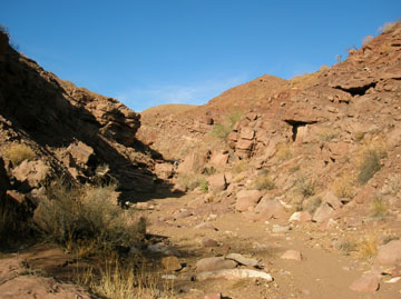
The entrance to the side canyon

In the side canyon
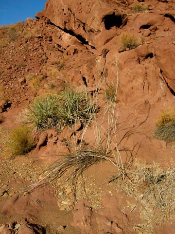
The white stick-like plant in the foreground is a strange desert milkweed.
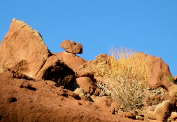
Cool balanced rock
By the time we reached the top of the side canyon, it was nearly 3:00, so we turned around. The increasingly slanting light of the return trip offered some great photographic opportunities. We arrived back at the car just as the last rays of sunlight were striking the ramparts above the entrance to red Canyon.


Splendid views on the way out

Sunset and the end of the trail
posted by Doug Taron @ 10:57
![]()
![]()


1 Comments:
Doug - That is gorgeous scenery and I'm sure more quiet land than you've seen in a while. Great photos. I WAS reminded of my home. Near the Owyhee Mountains in south Malheur County (SE Oregon) are two great spots: Leslie Gulch and Succor Creek. You made me homesick. THANKS for sharing your great hike.
Post a Comment
<< Home